|
|
|
|
Fire monitoring | ||||
|
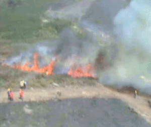
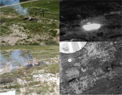
The intended operational environment is over the open field, or near inhabited zones. Real-time monitoring of the evolution of the fire is very useful for forest fire fighting. This monitoring involves dynamic information about the fire front and other parameters such as the flame height and the fire front width. Furthermore, the computation of the distances from the fire to the fighting means, houses, roads and utilities is also important. Aerial cameras are usually deployed on board of conventional aerial means (helicopters, airplanes). Fligths near the fire, with low visibility conditions due to the smoke, could involve significant risk. The use of smaller UAVs avoid these risks and decrease the operational costs.
The information obtained can be combined with GIS data to help to the management of the fire fighting activities, and also to post-fire analysis. The UAVs can deploy several cameras of different modalities to observe the scene from several points of view.
|
| Web Editor |
| Last modified: |